BLOG.QUAKOSEKIKI.DE
Hier schreibt Hotte ueber das, was er so tut und denkt. 
Quakosekiki Blog - Geocachen Artikel
Geocachen - ich cache seit 2008 unter dem nickname quakosekiki bei geocaching.com.
Letzte Caches fuer quakosekiki
WhereIGo und Adventure Lab Geocaches
Nach ueber 3000 Geocaches haben wir zwei fuer uns neue Cache Arten ausprobiert. Meistens machen wir Traditional Caches, manchmal Multicaches und alles andere ist ziemlich selten.
Am Rhein habe ich jede Menge WhereIGo Caches entdeckt - die gibt es dort seit letztem Jahr und zwischen Lauterbourg und Basel sind es sogar ein paar hundert !
Fuer WhereIGo caches braucht man eine eigene App - sobald man am Startpunkt ist, sagt die App einem, was man tun soll. So ein bisschen wie elektronisch unterstuetzte Multicaches. Es gibt aber nicht so viele davon und bisher habe ich nie einen gemacht, obwohl es die schon seit 2008 gibt.
In den Kommentaren zu den Caches am Rhein habe ich gefunden, dass die Caches gut mit Geooh GO funktionieren - ein Cacheprogramm, das Support fuer WhereIGo Caches eingebaut hat. Ich nutze jetzt schon ewig Locus Maps auf dem Handy - also habe ich Geooh GO gekauft und installiert und bei ein paar Caches ausprobiert.
Die Caches der "Noch xx Geocaches bis zur Grenze" Serie am Rhein funktionieren anscheinend alle gleich : vor Ort wird einem als einzige Information angezeigt, wie weit der Cache weg ist. Das reicht nicht wirklich um einen Cache zu finden ... Um den Cache zu starten braucht man einige Zahlen, die man von einem Puzzle bekommt, das auf der Cacheseite verlinkt ist. Wenn man das Puzzle vollstaendig puzzelt, hat man noch ein Spoilerbild zum Cache - damit kann man den Cache dann besser finden.
Die Puzzles sind unterschiedlich schwer - die mit weniger Puzzleteilen hatte ich in 20 Minuten fertig - bei den schwereren habe ich 90 Minuten gebraucht um ueberhaupt die notwendigen Zahlen zu puzzeln - das hat lange noch nicht gereicht um ein nutzbares Spoilerbild zu haben. Ohne vollstaendiges Spoilerbild standen wir vor Ort aber etwas hilflos da.
Eine kurze Suche, ob es "Unterstuetzung" zu den Puzzles bei jigsawexplorer.com gibt, hat eine Anleitung ergeben bei der man ein bisschen javascript veraendern soll um schnell zu einem fertigen Puzzle zu kommen - die aber mit der aktuellen Version nicht funktioniert hat. Im Debugger des Browsers habe ich aber schnell den API Call gefunden, der einem das vollstaendige Bild runterlaedt - damit braucht ein Puzzle dann nur noch eine Minute :-)
Mit den geloesten Puzzles waren wir wieder vor Ort - damit konnten wir immerhin so jeden 4. Cache finden. Bei jedem Cache immer die "WhereIGo Catridge" runterladen, die 6 Zahlen und die Sprache eingeben, auswaehlen, das man den Cache suchen will und dass man ihn wirklich suchen will um dann als einzige Info eine Entfernungsangabe zu bekommen, fand ich nicht so befriedigend. Immerhin - ein paar haben wir anhand der Fotos gefunden - die anderen werden fuer uns wohl versteckt bleiben.
Dann habe ich mir noch die Frage gestellt, ob das unterstuetzte Puzzle loesen auch mit einem Mobilbrowser vor Ort funktioniert. Chrome und Firefox haben aber in der mobilen Version keine Developer Tools und man kann auch keine Erweiterungen installieren.
Von Microsoft gibt es Edge Mobile - einen Browser, der auf der Chrome Engine aufbaut und es gibt eine Moeglichkeit da Extensions zu installieren. Ich habe ein paar Webentwicklungs Extensions in Edge getestet - keine davon hat mir dabei geholfen die Puzzle zu loesen - also habe ich Edge ganz schnell wieder deinstalliert.
Geooh GO zeigt auch Adventure Lab caches an - noch eine neue Cachesorte, die mir bisher noch nie aufgefallen war. Man braucht dafuer wieder eine andere App - die Adventure Lab App von Groundspeak - immerhin ist die kostenlos. Auch hier geht man zum Startpunkt und bekommt wie bei einem Multi-Cache bei jeder Station Informationen, was man als naechstes suchen muss. Also irgendwie auch wie bei einem WhereIGo Cache und auch wie bei einem Multi - nur eben elektronisch. Warum braucht man dafuer noch eine weitere Cache Sorte ? Es gibt in Lauterbourg zwei Adventure Lab Caches - die haben wir ausprobiert. Mit der Adventure Lab App funktioniert alles, wie erwartet - aber so richtig begeistert hat es uns nicht.
Normalerweis machen wir keine Multis - uns passiert es immer wieder, dass wir nach 5 Stationen alles gefunden haben, aber trotzdem keine brauchbaren Koordinaten fuer einen Final rauskriegen. Dann geben wir einfach auf, weil wir keine Lust haben alles nochmal durchzugehen. Ein Vorteil von dem elektronischen Multi war, dass einem immer die naechste Station angezeigt wird und man am Ende nicht dasteht und wegen irgendeinem Zahlendreher das Final nicht findet. Aber wie gesagt - ueberzeugt hat es uns nicht.
Da ich die Geooh GO Geocaching App jetzt gekauft habe, habe ich auch ein paar "normale" Caches damit gemacht. Das Programm funktioniert ohne gute Online Verbindung nicht (und die habe ich beim Cachen ganz oft nicht) und die Bedienung erscheint mir lange nicht so ausgereift, wie die von Locus Maps. Also habe ich die App auch wieder deinstalliert.
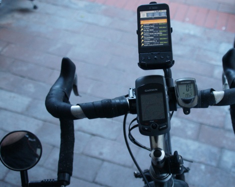
Wo ich gerade dabei war habe ich auch gleich mal wieder probiert, ob ich Geocaches auf mein Tacho uebertragen kann. Frueher war ich mit einem Garmin GPS cachen - danach sind die Handys so gut geworden, dass ich kein GPS mehr gebraucht habe - aber jetzt ist mein Tacho eh ein GPS mit einer ordentlichen Kartendarstellung - das waere ja beim Radfahren total praktisch !
Cachen funktioniert aber leider nicht mit dem Tacho ! Es gibt eine Menge Apps von Garmin - jede mit einem eingeschraenkten Zweck - aber keine, die Geocaches fuer das Tacho unterstuetzt. Die Garmin Explore App kann Geocaches lesen, aber nicht an ein Tacho uebertragen. Die Garmin Connect App kann mit dem Tacho reden - aber unterstuetzt keine Geocaches. Es gibt ein Windows Programm, mit dem das gehen sollte - soweit bin ich dann doch nicht gegangen. In den Kommentaren zu den Apps habe ich haeufig etwas in die Richtung gelesen : "die Garmin Geraete sind top - die Garmin Apps flop !" Das sehe ich leider auch so.
Insofern bleibe ich beim Rad-Geocachen bei der Loesung mit einer wasserdichten FidLock Halterung fuer das Handy - das funktioniert auch ganz gut.
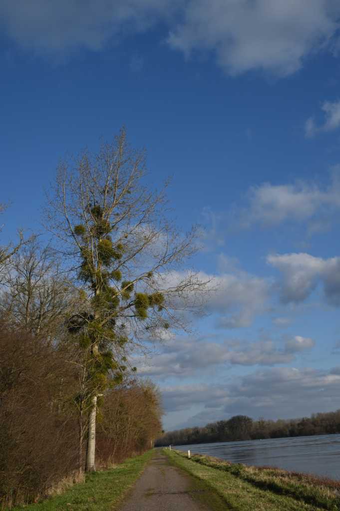
Caches am Rhein
zum Artikel - Kommentare, Vorschlaege, Fragen, Ergaenzungen, konstruktive Kritik, updates
3000 Geocaches
Nachdem ich 2017 den 2000ten Geocache gefunden habe, habe ich jetzt meinen 3000ten Geocache am Mittelmeer in Frankreich gefunden. In den letzten Jahren ist mein Schnitt langsam gefallen - fuer die ersten 1000 Caches habe ich 4 Jahre gebraucht, die zweiten 1000 haben 5 Jahre gedauert und fuer die dritten 1000 habe ich jetzt eher 7 Jahre gebraucht.
Vor 7 Jahren war die Verteilung auf Laender noch so, dass ich in Deutschland am meisten Geocaches gefunden habe, dann Spanien und dann Frankreich. Inzwischen ist Frankreich vor Spanien und auf Platz 4 ist Holland.
In der 81er Matrix mit allen Schwierigkeitsstufen von Geocaches fehlen mir noch 9 Kombinationen - alle haben eine Difficulty groesser als 3 (von 5).
An der Standard-Cache Ausruestung hat sich nicht viel geaendert : Handy, Stift, Stempel, Taschenlampe
Es sind noch ein paar Laender in den letzten Jahren hinzugekommen in den ich Caches gefunden habe : Malta, Jersey, Namibia, Schweden und Monaco. In der "naeheren" Umgebug moechte ich nochmal irgendwann nach Andorra und Zypern - aber sonst habe ich aktuell keine Plaene fuer weitere Laender.
Mit Namibia hat sich auch mein suedlichster und mein oestlichster Cache geaendert - die sind jetzt in der Kalahari. Der am weitesten entfernte Cache ist weiterhin in Guatelama.
Leider wird die Anzahl an aktiven Geocaches, die ich versteckt habe, immer kleiner - es sind nur noch 2 aktiv. Unser Cache in Lauterbourg wurde so oft geklaut, dass ich keine Lust mehr hatte neue Logbuecher zu platzieren - ich habe ihn dann deaktiviert.
Ich habe ueber 70 Trackables - also Geocoins oder Travelbugs, die von einem Cache zum anderen Reisen sollten. Jedesmal, wenn jemand ein Trackable findet und woanders wieder ablegt, bekommt man als owner eine Nachricht. Frueher habe ich die fast taeglich gekriegt - heute sind die meisten Trackables geklaut oder verschwunden - ich bekomme nur noch alle paar Monate mal eine Meldung.
Tatsaechlich benutze ich immer noch genau das gleiche Programm zum Cachen, wie vor 7 Jahren : Locus Maps. Inzwischen wurde das umbenannt nach Locus Maps Classic. Fuer die neuste Version moechte der Entwickler regelmaessige Zahlungen. Die Classic Version habe ich vor einigen Jahren gekauft - das ist in Ordnung fuer mich. Abos fuer Apps oder andere Software moechte ich eher vermeiden.
Vor kurzem haben wir den ersten privaten Cache gemacht - wir haben auf einem Weingut in Guntersblum in Rheinhessen uebernachtet und die haben ihren eigenen Multi mit 8 Stationen fuer ihre Gaeste versteckt. Der Cache war auch wirklich gut gemacht.
Nach 16 Jahren Geocachen habe ich immer noch Spass daran - immer wenn wir im Urlaub sind, suchen wir ein paar Caches und werden das wohl auch weiterhin tun.
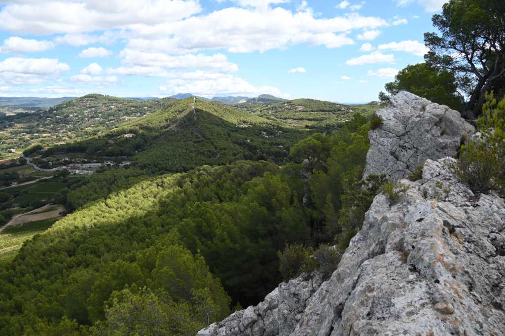
Mein 3000ter Cache ist direkt um die Ecke von diesem Fels
zum Artikel - Kommentare, Vorschlaege, Fragen, Ergaenzungen, konstruktive Kritik, updates
Meilenstein 2000 Caches
von quakosekiki@ 2017-06-10
2000 Caches habe ich jetzt ! (natuerlich nicht genau, sondern etwas mehr)
Wie den 1000. habe ich auch den 2000. im Urlaub in Spanien gefunden.
Wir haben den dritten Teil einer schoenen Cacheserie gemacht : Rio Secco - die anderen beiden Teile haben wir in den letzten beiden Jahren gemacht (sehr schoene Serie und tolle Landschaft in einem groesstenteils ausgetrockneten Flussbett)
Da wir regelmaessig in Spanien cachen, habe ich auch in Spanien am zweitmeisten Caches gefunden (nach Deutschland) : 262 Funde Als naechstes kommt dann Frankreich mit 180 Caches - das wird anteilig jetzt sicherlich mehr.
Insgesamt habe ich 19 Laender - das letzte Projekt dazu war ja in allen Laendern rund um Deutschland Caches zu finden - das hab ich geschafft.
An der Matrix hat sich nicht viel getan - die Caches mit hohen D-Wertungen sind immer noch nicht mein Ding. (ueberhalb von D3 fehlen mir noch 15 Kombinationen - hauptsaechlich mit mittleren T-Wertungen)
Und 63 eigene Trackables habe ich auf den Weg gebracht (bis auf die Duppeglas Coin, die steht zu Hause).
Zu 95% habe ich Tradis gefunden - liegt mir einfach am meisten.
Ich habe immer noch keinen einzigen FTF - macht nichts.
zum Artikel - Kommentare, Vorschlaege, Fragen, Ergaenzungen, konstruktive Kritik, updates
Geocache in Portugal
von quakosekiki@ 2015-05-03 - 20:32:34
Kurzurlaub ueber den ersten Mai in Porto und jetzt habe ich auch endlich einen Geocache in Portugal gefunden. Portugal hat mir ja schon lange gefehlt. Ausser allen Laendern rund um Deutschland habe ich jetzt auch in allen Laendern suedlich und westlich von Deutschland Gocaches gefunden. (also nach meiner Definition, alles, was in Mitteleuropa liegt halt irgendwie) (ausser Stadtstaaten) Da gibt es doch eine ganze Menge Laender.
Das naechste Geocaching Projekt ist : alle interessanten Cache Arten mindestens einmal finden.
Da gibt es die offiziellen Cache Arten : Traditional, Multi, Event, Virtual, Earth Cache, ... da fehlt mir bloss das CITO Event (Cache in, Trash out) - da muss ich mir mal eins aussuchen.
Dann gibts Traditionals, die unterschiedlich versteckt sind : Baumklettercache, Felsklettercache, Brueckenabseilcache, Steinbruchabseilcache, Paddelcache, Nachtcache, Power Trails, ... da fehlen mir noch : ein Hoehlencache und ein Tauchcache.
Also wieder was zu tun... und als naechstes kommt dann die Marke von 2000 Caches.
Mit Projekt 81 wuerde ich wahrsheinlich nie fertig werden - deshalb nehme ich mir das gar nicht erst vor. Ich hab alle Caches bis zur Schwierigkeit 3 gefunden und dadrueber noch viele Loecher. Ich hab halt keine Lust zu Hause zu sitzen und Raetsel zu loesen - da fahre ich lieber draussen rum und suche D1 / T5 Caches.
Aber wenn mal jemand einen Tip hat, wie man Caches mit D groesser 3 ohne viel Raetseln findet, bin ich dabei.
zum Artikel - Kommentare, Vorschlaege, Fragen, Ergaenzungen, konstruktive Kritik, updates
Geocaches in allen Laendern rund um Deutschland gefunden
von quakosekiki @ 2014-11-08 - 15:07:58
Ich hab mir vor einiger Zeit mal vorgenommen in allen Laendern, die an Deutschland angrenzen, mindestens einen Cache zu finden. Das sind ganz schoen viele ...
Dafuer muss man ein bisschen reisen und ich hab das auch recht schnell fuer alle Laender geschafft - ausser fuer Polen.
Was ein bisschen witzig ist, Polen ist nach Finland und Deutschland das Land, wo ich am laengsten gewohnt habe ... aber da habe ich noch nicht gecacht und in den letzten Jahren bin ich einfach nicht hingekommen.
Jetzt hatte ich einen Nachtzug nach Goerlitz und einen wieder zurueckgebucht und hatte einen halben Tag zum Cachen vorgesehen - von da kann man einfach ueber die Grenze laufen :-)
Dummerweise sind die Zuege wegen des Lokfuehrerstreiks ausgefallen - jetzt bin ich halt gestern 1400 km mit dem Auto gefahren und habe 2 Caches in Polen gemacht :-)
http://coord.info/GC1F23F
http://coord.info/GC1PKB9

Mal schauen, was ich mir als naechstes CacheZiel vornehme. Zum Cache Verstecken habe ich aktuell nicht so viel Lust, da Caches auf Baeumen wohl nicht mehr so einfach freigegeben werden.
zum Artikel - Kommentare, Vorschlaege, Fragen, Ergaenzungen, konstruktive Kritik, updates
Cache verstecken
von quakosekiki @ 2012-11-07 - 18:05:06
Also mir ist erstmal die Lust zum Cache verstecken vergangen.
Das ist jetzt mein dritter Cache, den ich wieder abbaue.
Beim ersten war der Final eines Multis zu dicht.
Beim zweiten (immerhin ein T5, den ich auf einen sorgfaeltig ausgesuchten Baum gebracht habe) war der Final eines Mysteries zu dicht an den Koordintaen. Der Mystery war fast 3 Kilometer entfernt und im Umkreis von 3 km gabs knapp 100 Mysteries - die kann man ja nicht alle vorher loesen.
Der dritte war dann nach einiger Diskussion zwar weit genug weg von Bahnschienen, aber in einem Tunnel, den man ohne jegliches Hindernis betreten kann :
"Kanaele und Tunnel stehen in Deutschland ueblicherweise im privaten oder oeffentlichen Eigentum. Da - anders als bei Strassen und Wegen - keine Widmung zur Nutzung durch die Allgemeinheit vorliegt, muss der Betreiber den Zutritt durch Betriebsfremde nicht dulden. Eventuell kann ein Betreten auch strafrechtliche Konsequenzen nach sich ziehen."
Ich hab vorerst keinen Bock mehr darauf Caches zu verstecken. Vor allem welche, wo nicht einfach eine Filmdose an der Leitplanke haengt.
zum Artikel - Kommentare, Vorschlaege, Fragen, Ergaenzungen, konstruktive Kritik, updates
Geocache verstecken
von quakosekiki @ 2012-06-23 - 11:07:42
Ich habe versucht einen Cache zu verstecken. Nicht, dass ich das das erste mal gemacht habe, aber dieses mal habe ich mich ein bisschen geaergert.
Es sollte ein einfacher Kletterbaum werden zum Ueben. Ein Waldstueck und darin ein Baum war schnell gefunden. Leider sind rundherum ein paar Mysteries - aber ich konnte Leute finden, die die Koordinaten hatten oder sie fuer mich geloest haben - kein Problem mit der Abstandsregel.
Also Cache versteckt und gepublisht - 2 Tage spaeter kommt die Antwort :
"Verlege den Cache bzw. die betreffenden Stationen so, dass der Mindestabstand zu benachbarten Caches und deren Stationen von 0,1 Meile = 161 Meter eingehalten wird.Dadurch soll die Cachedichte in einem ertraeglichen Mass gehalten werden.
Details: (visit link) und (visit link)
Momentan gibt es mit folgenden Caches Abstandskonflikte:
XXXXXXXXXX
Es gilt immer der Abstand per Luftlinie. Wir duerfen aus verstaendlichen Gruenden keine weiteren Details ueber andere Cache herausgeben, darum gehe im Zweifelsfall entweder den Cache selber suchen oder kontaktiere dessen Owner. Vielleicht hilft er Dir, Deinen Cache konfliktfrei anpassen zu koennen."
Der benannte Mystery ist 3 km entfernt auf einem Autobahnkreuz und ich hab natuerlich nicht damit gerechnet, dass der Final genau dort im Wald ist. Das ganze ist ein T2 D4 - da ich keinen Spass an Raetseln habe ist das keine Option fuer mich, sowas zu loesen. Also nochmal dem Reviewer geschrieben, wie ich denn sicherstellen kann, dass ich an einenm anderen Baum nicht das gleiche Problem habe und dass doch die Verwechslungsgefahr zwischen einem Cache auf einem Baum und einem T2 nicht so hoch ist. Die Antwort kam gleich :
"vielen Dank fuer deine Rueckeldung; bei der Abstandsregel geht es - wie beschrieben - nicht um eine Verwechslungsgefahr.
Ich denke dir wird nichts anderes uebrig bleiben, als die Caches in der naeheren Umgebung zu suchen, eine andere Moeglichkeit (ausser der Mithilfe der anderen) gibt es nicht. Das kommt dem Gedanken von Geocaching ja auch am naechsten."
In der "naeheren Umgebung" von 3 km gibt es fast 100 Mysteries. Die ich natuerlich alle nicht gefunden habe, da ich nunmal keinen Spass an Mysteries habe.
Fuer den konkreten Fall habe ich jemanden gefunden, der mir die Koordinaten von dem konkurrierenden Final verraten hat - also suche ich mir einen anderen Baum und hoffe, dass die Finals der anderen 100 Mysteries nicht auch alle in dem Wald sind. Aber wirklich Spass macht mir das Verstecken so nicht - was habe ich da an dem erwaehnten "Gedanken vom Geocaching" nicht verstanden ?
Kennt irgendjemand eine Moeglichkeit trotzdem noch Caches verstecken zu koennen ?
(mir faellt da nur ein - keinen Cache verstecken, eine Dummy Beschreibung an den Wunschkoordinaten publishen, auf das Reviewer Log warten und falls man keinen Konflikt hat : schnell wieder deaktivieren und tatsaechlich einen Cache verstecken. Das waer dann bloed fuer diejenigen, die versuchen FTFs zu bekommen. Oer - so hab ich das in der Vergangenheit auch schon gemacht : Cache verstecken und halt wieder entfernen, wenn man einen Konflikt hat und eben keinen neuen Cache erstellen)
zum Artikel - Kommentare, Vorschlaege, Fragen, Ergaenzungen, konstruktive Kritik, updates
Geocaching Projects
von quakosekiki @ 2011-03-16 - 10:14:13
Viele Cacher haben beim Geocachen Projekte. Am oeftesten hab ich jetzt Projekt 81 gehoert - also alle 81 moeglichen D/T Kombinationen finden. Da ich Caches mit hohen D-Wertungen nicht so mag, ist das kein Ziel fuer mich.
Mein aktuelles Projekt ist es, in allen Laendern rund um Deutschlad herum mindestens einen Cache zu finden. Nachdem ich jetzt endlich einen Cache in Daenemark gefunden habe, fehlt mir nur noch Polen - also noch ein Ziel fuer dieses Jahr.
Ausserdem habe ich das Projekt : pro Hundert gefundenen Caches einen Geocache selber zu verstecken.
Aktuell hab ich 691 gefundene Caches und diese eigenen Caches
Astgabel 18 http://coord.info/GC1A73H
Astgabel 16 http://coord.info/GC1CW3C
Astgabelnnn http://coord.info/GC2HMYE
HFG + EU http://coord.info/GC1JMG9
Und bei diesen Caches mitgewirkt
...das baum zwei punkt null... http://coord.info/GC1GDY2
Hinterland http://coord.info/GC26171
Nachmieter http://coord.info/GC2E6PN
Weitere Projekte hab ich nicht, ausser moeglichst viel eigene Geocoins im Umlauf zu haben - vielleicht wirds noch mehr Kontinente sammeln - aktuell hab ich erst Mittelamerika, Afrika und Europa.
zum Artikel - Kommentare, Vorschlaege, Fragen, Ergaenzungen, konstruktive Kritik, updates
Geocaching Accessories
von quakosekiki @ 2011-03-15 - 10:02:51
Meine persoenliche Liste an Dingen, die man zum Cachen so braucht - ich hatte ja schonmal was ueber die Kletterausruestung geschrieben - was braucht man denn noch so :
Wirklich in dieser Reihenfolge :
* als allerstes braucht man einen Stift, besser mehrere
* GPS
* Taschenlampe, am besten eine Stirnlampe
* Geocoins oder Travelbugs
Weiterhin praktisch :
* feste Schuhe. lange und brombeerfeste Hose, Regensachen
* bei Mysteries oder Multis auf jeden Fall (sonst optional) Handy mit Internet und was zu schreiben
* Pinzette, Zange, Magnet oder Greifer um den Cache oder das Logbuch rauszukriegen
* Ersatz Zettel, Logbuch oder sogar Behaelter, falls mal was kaputt ist
* im Winter eine Lawinenschaufel um den Cache unter dem Schnee zu finden
* Verpflegung und was man sonst so typisches auf laengeren Wanderungen braucht
* Kamera um Caches zu dokumentieren, die man vielleicht nicht mehr loggen kann
Bei Nachtcaches :
* mehrere Taschenlampen
* evtl. auch UV Taschenlampe
Bei Multis und Mysteries
* ganz viel Geduld und am besten mehrere Leute, damit man das durchsteht
* eine Kamera um alle Zwischenergebnisse zu dokumentieren
* ausgedruckte Cachebeschreibung
Um einen Cache zu verstecken :
* am allerwichtigsten eine gute Idee an einem Platz, wo es in der Naehe noch keine Caches gibt
* einen moeglichst wasserdichten Behaelter
* Logbuch, Stashnote
Ausruestung Klettercachen
von quakosekiki @ 2010-10-14 - 21:47:51
Ich wurde jetzt schon ein paar mal gefragt, was man denn als Geocacher so zum Klettern braucht. Haengt davon ab.
Bei Abseilcaches reicht meist schon das Basisset und ein Seil - bei anderen Caches wird es etwas umfangreicher ...
Basisset :
* Klettergurt
* ein paar Schraubkarabiner (am besten HMS) und Bandschlingen (verschieden lange) - jeweils mindestens (!) 2
* Abseilgeraet bzw. Sicherungsgeraet : ATC (besser) oder Acht
* Schuhe (zum Abseilen und Aufstieg am Seil Turnschuhe, fuer Fels oder Halle Kletterschuhe)
Zum Aufsteig am Seil :
* Statikseil, Seilsack
* Steigklemmen, 2 Stueck und noch weitere Karabiner und Bandschlingen
* Wurfsack und Pilotleine, evtl. noch Wurfsackbeschleunigungsapparatur
Felsen :
* Expressschlingen und Klemmgeraete (evtl. viele ...) sofern man Vorstieg machen will (nur fuer Fortgeschrittene)
* weitere Bandschlingen und Karabiner
* evtl. Chalkbag, Klemmkeilentferner, Kletterfuehrer
Ansonsten noch hilfreich natuerlich :
* Helm (gerade beim Abseilen)
* Stirnlampe
bzw. fuers Geocaching natuerlich sowieso immer :
* GPS
* Stift
* Papier
Wenn man mal in der Halle ueben will :
* Schuhe, Klettergurt, Sicherungsgeraet reichen
zum Artikel - Kommentare, Vorschlaege, Fragen, Ergaenzungen, konstruktive Kritik, updates
ready to cache ...
von quakosekiki @ 2010-08-12 - 20:24:02
zum Artikel - Kommentare, Vorschlaege, Fragen, Ergaenzungen, konstruktive Kritik, updates
Mein 200ster Cache
von quakosekiki @ 2008-06-16 - 00:57:17
So - jetzt cache ich schon seit fast einem halben Jahr - vor 3 Monaten habe ich meinen 100sten Cache geloggt - heute meinen 200sten !
Es ist ein T4,5 von Schnitzel und eine Geocoin hab ich auch dagelassen.
Bei meinen letzten 100 Caches waren viele zum Klettern oder Abseilen dabei, ich war in Karlsruhe im Untergrung, im Piesberg in einem alten Stollen auf einem Hochspannungsmasten, auf einem Laternenpfahl, hab an diversen Aussichtstuermen abgeseilt und bin mal wieder an Bruecken rumgeklettert.
Ausserdem bin ich inzwischen in 11 verschiedenen Laendern gewesen - eine Moped Tour durch die Alpen und eine BeNeLux Rennradtour haben mich da stark vorangebracht ...
Nebenbei hab ich noch ein Cache Event fuer meine Abteilung organisiert (nicht geloggt :-) und meinen zweiten Astgabel Cache versteckt.
Dafuer gibts es im Umkreis von ueber 3 Kilometern jetzt nur noch einen Traditional, den ich nicht gefunden habe - ein Nano - da war ich auch schon 3 mal und hab ihn nicht entdeckt !
Ich hab jetzt Cache Touren mit Stoepfs, den Passanten und Schnitzel gemacht und auch einige Nicht Cacher mal mitgenommen.
Fazit : weiterhin eine feine Sache - bloss die nicht gefundenden Caches hier in der Umgebung nehmen schon ab - die naechsten 100 werden wohl laenger dauern ...
zum Artikel - Kommentare, Vorschlaege, Fragen, Ergaenzungen, konstruktive Kritik, updates
Geocaching
von quakosekiki @ 2008-03-16 - 00:10:55
Mal wieder was zum Geocaching
Also als 100 sten Cache hab ich mir einen WebCam Cache ausgesucht, ich war bei einem Geocaching Stammtisch, hab jetzt Traditionals, Mysteries, Multis und Webcacm Caches gemacht und heute hab ich auch meinen ersten erfolgreich versteckt und freigeschaltet ist er auch schon. Ich fand es gab zu wenige, wo man sich beim Klettern auch ein bisschen anstrengen muss :-)
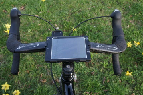
Hier noch ein Foto von meinem aktuellen GeoCaching mobil - einziger Haken : die GPS Halterung gabs nicht in Carbon ... sonst gefaellts mir !
zum Artikel - Kommentare, Vorschlaege, Fragen, Ergaenzungen, konstruktive Kritik, updates
Paperless Geocaching Software
von quakosekiki @ 2008-02-12 - 00:58:32
Also viel braucht man nicht zum Geocaching.
Wie gesagt ein GPS und eine Taschenlampe sind Pflicht.
Ich hab ein GPS in meinem Windoof Mobile Geraet - das funktioniert auch erstaunlich zuverlaessig.
Und dank grossem Display, entsprechendem Datentarif und der noetigen Software gehts auch mit wenig Vorbereitung komplett Paperless.
Als GPS Programm habe ich GIS Russa. Hat genau die Funktionen, die man braucht, ist uebersichtlich genug und funktioniert zuverlaessig.
Ich hatte vorher ein paar andere (unter anderem GPS Tuner gekauft) aber die sind entweder ziemlich unuebersichtlich, langsam oder instabil.
Mit dem GPS Programm hat man schon das meiste abgedeckt.
Google Maps ist noch ganz witzig, aber man brauchts nicht wirklich. Was nett gewesen waere : KML Dateien erzeugen und die Caches dann in Google Maps Mobile anzeigen - das kann aber nur 9 Wegpunkte anzeigen - so macht das keinen Spass.
Dafuer habe ich dann noch Cache Wolf. Hauptsaechlich zum Cachebeschreibungen anzeigen und Konvertieren von Wegpunkten. Bei geocaching.com kann man als Premium Mitglied Pocket Queries erstellen - z.B. alle 300 Traditional Caches um Karlsruhe - und sich die dann als gezippte Datei per mail zuschicken lassen. Das Format kann GIS Russa aber nicht lesen. Cachewolf kann die aber lesen und als OZI Datei wieder rausschreiben - die kann man dann mit GIS Russa lesen.
Wenn ich nun irgendwo in Karlsruhe bin und Lust zum Cachen habe, schmeisse ich also nur das GPS an, kuck mir an, was so in der Naehe an Caches ist, lese mir noch die Cachebeschreibungen durch und fahr hin.
Mit dem Pocket Opera kann man dann auch gleich loggen.
Um die ganze Prozedur dann komplett mobil durchzufuehren braucht man nur noch ein Mailprogramm - ich hab nach langem Suchen Profimail auserkoren (und das ist wirklich gut!).
Der Advantage haelt akkumaessig problemlos einen Tag cachen durch und auch die Daten, die man dann uebertraegt, um doch nochmal die neusten Kommentare zu einem Cache zu lesen oder zu loggen, halten sich in Grenzen.
Mit dem 5 Zoll Display kann der Advantage mit ein bisschen gutem Willen sogar die Taschenlampe ersetzen ... aber zum Glueck hab ich eh immer eine Maglite dabei, sodass ich das noch nicht brauchte.
Momentan warte ich noch auf die bestellte Lenkerhalterung, sodass ich alle Daten dann auch auf dem Fahrrad staendig vor der Nase hab ...
zum Artikel - Kommentare, Vorschlaege, Fragen, Ergaenzungen, konstruktive Kritik, updates
Neues Hobby
von quakosekiki @ 2008-02-11 - 00:48:43
Ich hab seit einem Monat ein neues Hobby. Geocaching.
Hat so ein bisschen Suchtfaktor - Steffi hat mich Anfang Januar mal zu einem Cache mitgenommen und im letzten Monat hab ich jetzt ueber 50 davon gefunden ...
Funktioniert ganz einfach : irgendwer verstekct einen Cache und postet die GPS Koordinaten auf geocaching.com oder einer vergleichbaren Seite. Da ist dann ein Behaelter versteckt, wo zumindest ein Logbuch drin ist.
Man begibt sich dann mit GPS zu der Koordinate - bis dahin ists meistens ganz einfach - und sucht dann im Umkreis von ein paar Metern diesen Behaelter. Und das kann schonmal etwas dauern, wenn z.B. eine Filmdose mit einem Magneten aussen an einer Bruecke befestigt ist, sodass man sie praktisch nicht sieht oder wenn die Koordinaten vor einem Parkhaus sind und man dann an einem Hinweis den richtigen Parkplatz finden muss oder wenn man erstmal 15 Meter einen Baum hochklettern muss< ...
Besonders die Caches, wo man erstmal Klettern muss, gefallen mir natuerlich besonders !
Hat man den Cache gefunden, traegt man sich ins Logbuch ein, logt den Fund noch auf der Webseite des Caches und versteckt den Cache an der gleichen Stelle wieder.
Ein einfacher Cache dauert meist unter einer halben Stunde, man ist immer draussen unterwegs und man kriegt einiges zu sehen an schoenen Ecken, die man vorher nicht kannte.
Ausser einem GPS und einer Taschenlampe braucht man fuer die meisten Caches nichts.
Kann ich nur empfehlen ...